Site & indicative layout
Our illustrative masterplan shows how we intend to make effective use of the site, balancing a mix of different sized units for potential occupiers with new pedestrian and cycle links for the general public, opening up the currently inaccessible site and the River Lea to the public.
We’ve now submitted a ‘hybrid’ planning application for the site to reflect the phased approach to developing the site. A ‘detailed’ planning application has been submitted for Phase 1 (the area to the west of the River Lea as seen in the indicative masterplan below), while an ‘outline’ planning application has been submitted for Phase 2 (the area to the east of the river), focused on the parameters of this part of the site. Further detail for Phase 2 will be defined at a later date.
Please refer to the plans below for further details.
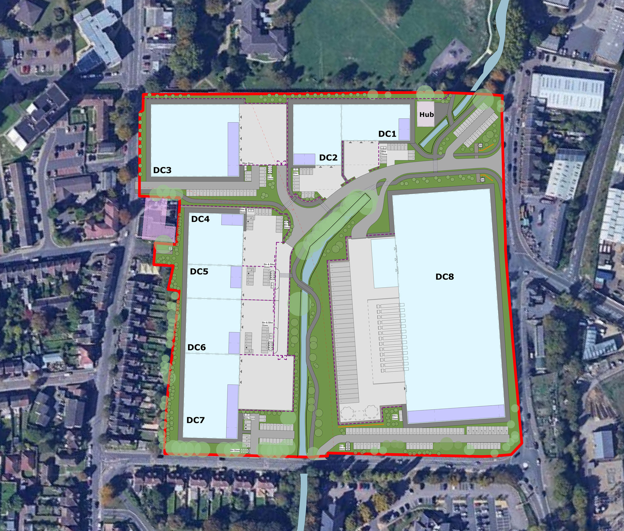
Illustrative masterplan of the site. Click image to enlarge
Pinch to zoom
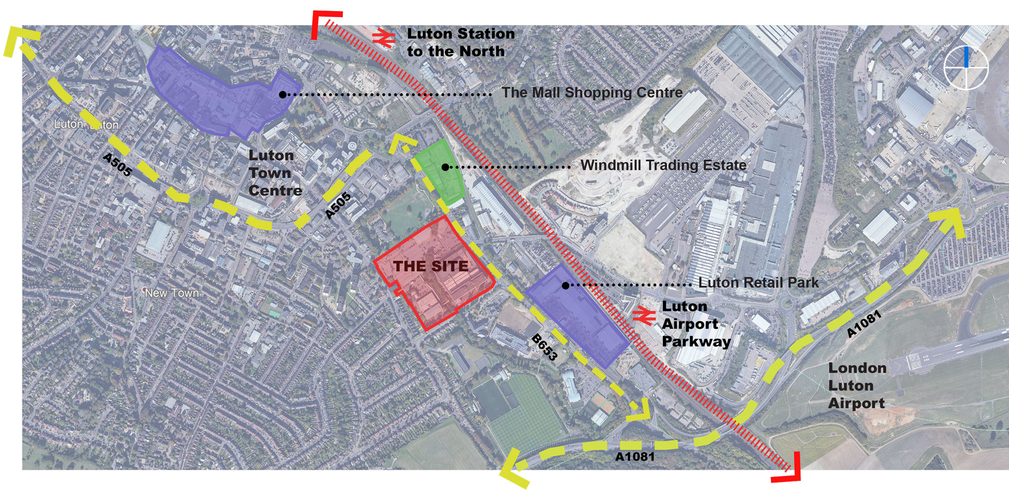
Site location plan. Click image to enlarge
Pinch to zoom
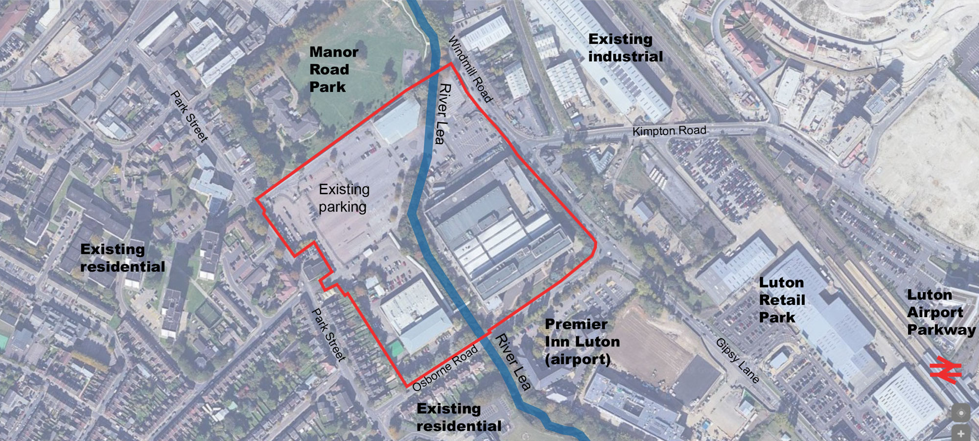
Immediate area around the site. Click image to enlarge
Pinch to zoom
Downloads
Click here to download documents and information:
Contact us
You can get in touch with us here.